|
CAPPADOCIA |
|
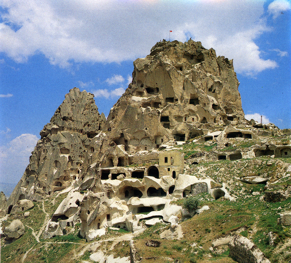
UCHISAR This place resembles a castle from a distance. The village lies at the root of the rock-blocks, which are perforated in the usual manner. From the top there is a magnificent panorama of the plateau. In the afternoon, the light is ideal for panoramic pictures.
Uchisar NEVSEHIR Nevsehir was formed on the western end of the famous tuff landscape of Cappadocia. The old name of this central Anatolian city was Nissa and it had a population of 150,000. It lies on the slopes of a hill, on whose summit rises the citadel of the Seljuks. Kursunlu camii (Mosque-with-Lead), which was built in 1726 by the Grand Vizier Damat Ibrahim Pasa, the citadel of the Seljuks, and Kaya camii (Rock Mosque) are all worth seeing. THE SUBTERRANEAN CITY-KAYMAKLI
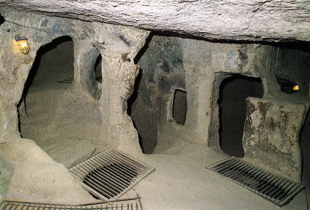
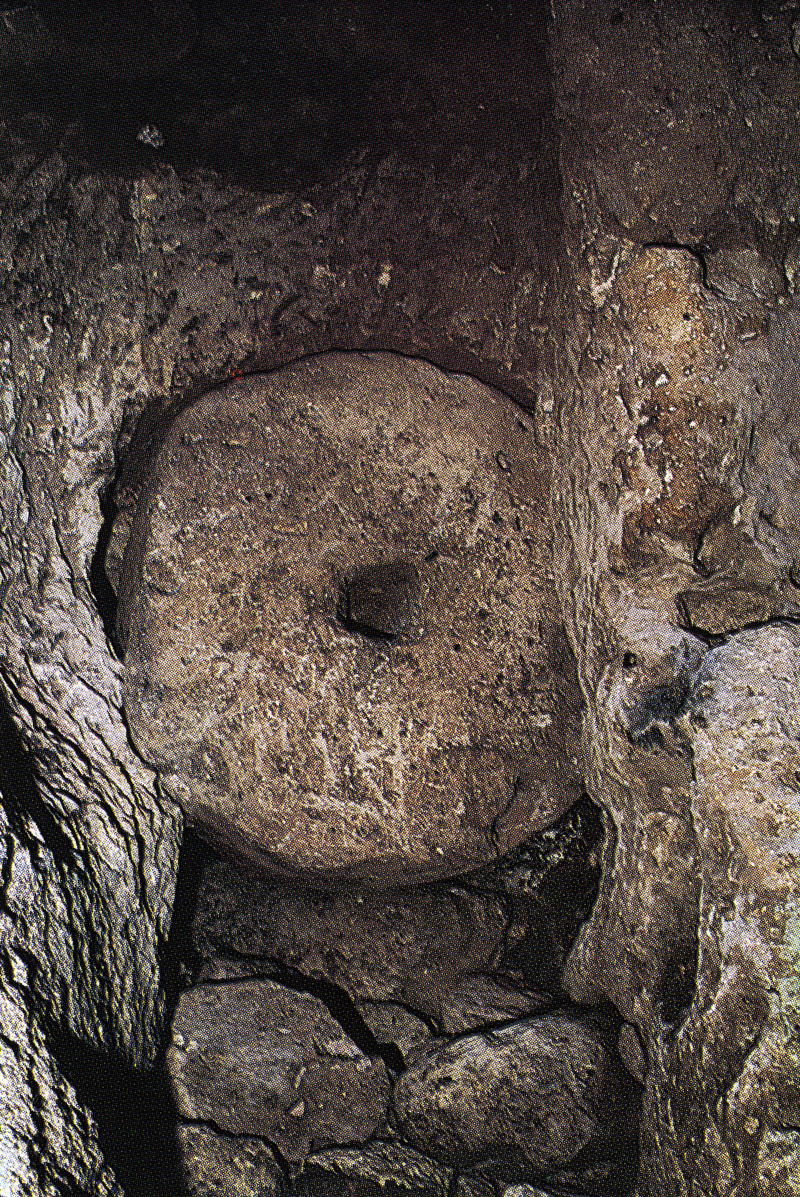
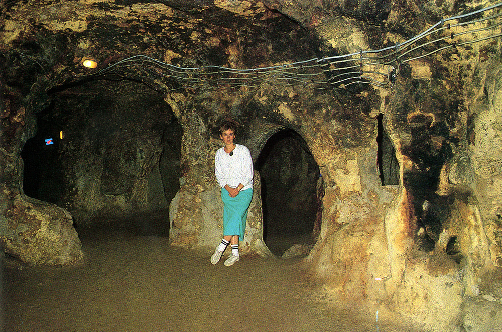
Kaymakli This is situated 20 km to the south of Nevsehir. Like the other subterranean cities it was a place of refuge for Christians before the Arab invasion. The air supply was drawn through ventilating chimneys. In this city of eight levels, each level was connected to each other by narrow corridors. To subdivide the layers, millstones-round stone blocks with a diameter of 1-1,5m were used. The length of the passages totalled approximately 30km. Probably this subterranean city gave shelter to 15,000 people. One can see amongs other things: bedrooms, a lot of passages, a church, a meeting hall, and storage rooms for food. THE SUBTERRANEAN CITY-DERINKUYU
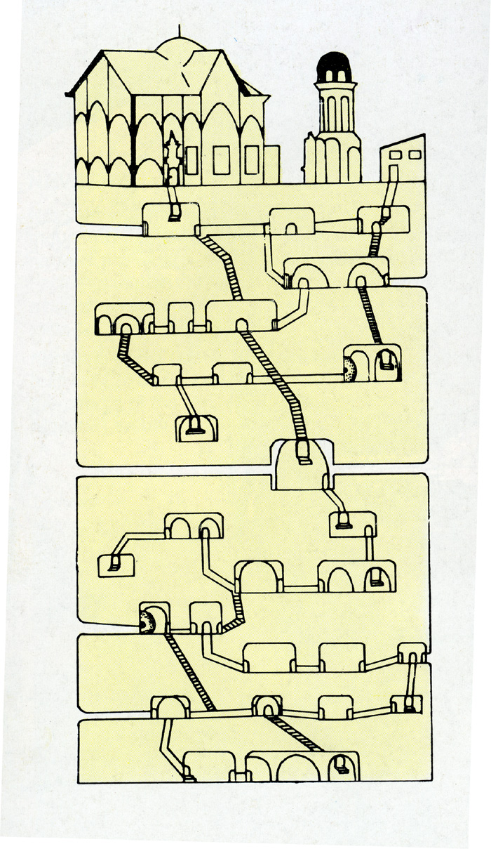
Plan of the underground city of Derinkuyu
Wheel doors
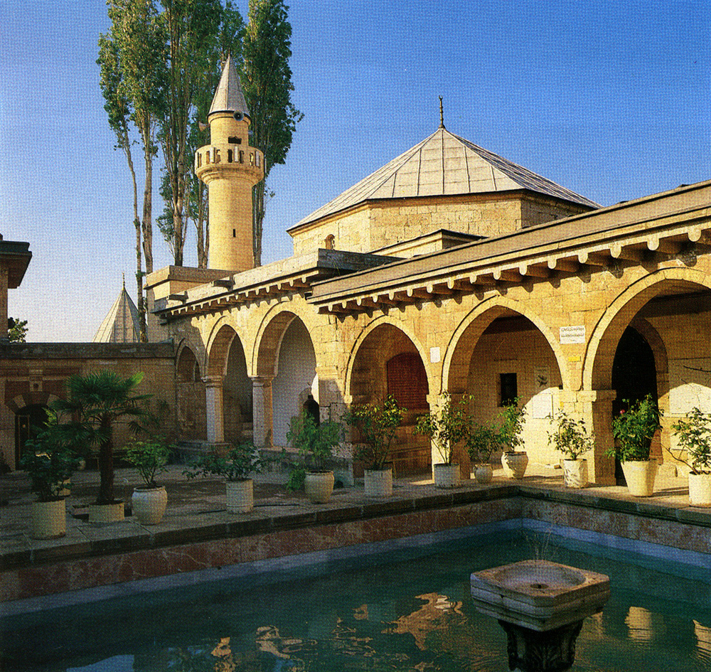
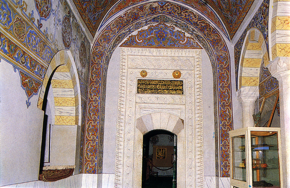
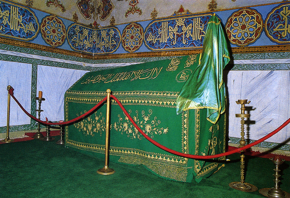
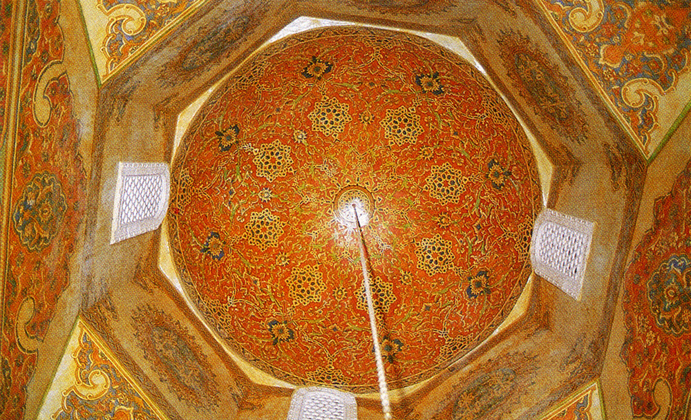
Derinkuyu Derinkuyu is the second subterranean city, and lies 10km to the south of Kaymakli. It was discovered by chance in 1968. Pre-Christians would have settled here, perhaps the Hittites. Up until the present, eight layers have been excavated. The city is 55m deep and has a surface area of 2,500 sq m. Probably 30 more subterranean cities exist in the area. Derinkuyu would have been the largest one with its 10,000 inhabitants. The city is subdivided in the following manner: On the first layer are a bedroom, a dining room, a kitchen, a wine cellar and a stable. On the second layer there is a church with an altar. On the third and fourth layers are kitchens, a place of refuge, a mission school, an ordnance depot and a baptismal font. The city has 52 air shafts, with a depth of 80m. The bottom section served as a water depot. HACI BEKTAS - 20 km from Mucur The village in which stands the cloister (tekke) of Bektasi Dervish orders, is named after it. The founder Haci Bektas Veli, lived in the 13th century. His orders started in the 15th century. The cloister in which Haci Bektas himself lies, can be called the most important cloister of the orders. Here one can also find the only remaining Bektasi cloister. Followers of the orders wear white caps. These orders used to have close relations with the Janisseries. Followers of the orders believe in the transmigration of souls. They confess their sins to their superiors and obtain absolution. Their modern ideology is based on loving individuals and peace. Polygamy and divorce are frowned upon. The museum of Haci Bektas Veli consists of three courtyards: In the first courtyard there is a fountain "Ucler Cesmesi," a bath and the laundry of the cloister. In the centre of the second courtyard stands a large fountain surrounded by a guest-house, a kitchen and a display hall. On the right side of the third courtyard lies the museum-like and decorated mausoleum of Haci Bektas Veli (Pir evi). At the right and left of the doorway there, superiors of the orders were buried. The sarcophagus of Haci Bektas Veli (Huzur-u-Pir) is in a room with a marvelous dome painting.
Mausoleum (turbe)
Entrance of the museum
Sarcophagus of Haci Bektas
Dome of the mausoleum |